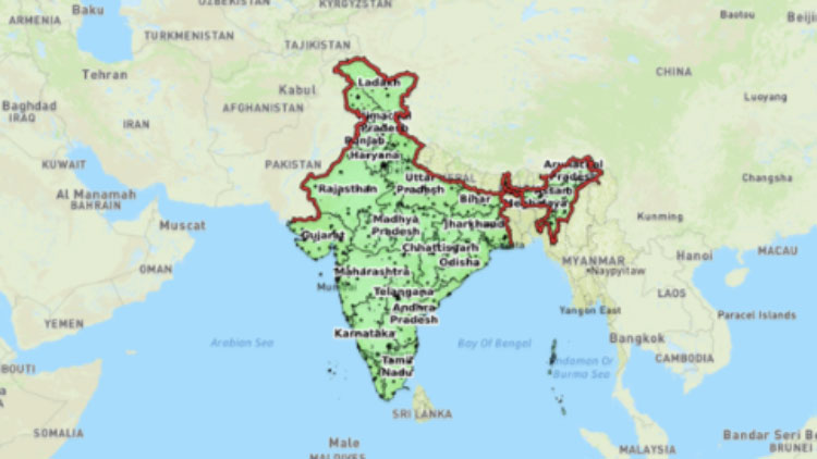
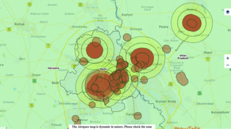
DGCI Airspace Map is available on DGCA’s digital sky platform at https://digitalsky.dgca.gov.in/home.
The Central Government, led by Prime Minister Shri Narendra Modi, has released India’s airspace map for drone operations on September 24, 2021, taking another step toward realizing our joint vision of an Aatmanirbhar Bharat. The map can be found at https://digitalsky.dgca.gov.in/home on the DGCA’s digital sky platform.
The drone airspace map is a follow-up to the Central Government’s liberalizedDrone Rules, 2021, which were announced on August 25, 2021, the PLI scheme for drones, which was released on September 15, 2021, and the Geospatial Data Guidelines, which were released on February 15, 2021. All of these policy changes will help the drone industry grow faster than expected.

WHY ARE DRONES IMPORTANT?
Drones offer tremendous benefits to almost all sectors of the economy. These include – agriculture, mining, infrastructure, surveillance, emergency response, transportation, geo-spatial mapping, defense, and law enforcement to name a few. Drones can be significant creators of employment and economic growth due to their reach, versatility, and ease of use, especially in India’s remote and inaccessible areas.
Given its traditional strengths in innovation, information technology, frugal engineering, and its huge domestic demand, India has the potential of becoming a global drone hub by 2030.
WHAT’S THE LIKELY IMPACT OF THESE DRONE INITIATIVES?
Thanks to the new rules, the drone PLI scheme, and the freely accessible drone airspace maps, the drones and drone components manufacturing industry may see an investment of over INR 5,000 crore over the next three years. The annual sales turnover of the drone manufacturing industry may grow from INR 60 crore in 2020-21 fold to over INR 900 crore in FY 2023-24. The drone manufacturing industry is expected to generate over 10,000 direct jobs over the next three years.
The drone services industry (operations, mapping, surveillance, agri-spraying, logistics, data analytics, software development, etc.) will grow to an even larger scale. It is expected to grow to over INR 30,000 crore in the next three years. The drone services industry is expected to generate over five lakh jobs in three years.
TOP 10 FEATURES OF THE DRONE AIRSPACE MAPS
- The drone airspace map is an interactive mapof India that demarcates the yellow and red zones across the country.
- Green zone is the airspace upto 400 feet that has not been designated as a red or yellow zone; and upto 200 feet above the area located between 8-12 km from the perimeter of an operational airport.
- In green zones, no permission whatsoever is required for operating drones with an all-up weight upto500 kg.
- Yellow zone is the airspace above 400 feet in a designated green zone; above 200 feet in the area located between 8-12 km from the perimeter of an operational airport and above ground in the area located between 5-8 km from the perimeter of an operational airport.
- Drone operations in yellow zone require permission from the concerned air traffic control authority – AAI, IAF, Navy, HAL etc. as the case may be.
- Yellow zone has been reduced from 45 km earlier to 12 km from the airport perimeter.
- Red zone is the ‘no-drone zone’ within which drones can be operated only after a permission from the Central Government.
- The airspace map may be modified by authorised entities from time to time.
- Anyone planning to operate a drone should mandatorily check the latest airspace map for any changes in zone boundaries.
- The drone airspace map is freely available on the digital sky platform to all without any login requirements.
Read more at TravelMail | Follow us at Facebook | Twitter | Instagram for on the go news


